
URBANITE: Messina Use Case in Smart Mobility Scenario
The urban transformation, and the changes that the world is undergoing, lead, today more than ever, to the need to make faster and more timely choices in the field of mobility management. Technology is therefore essential for providing decision support tools that help managers and politicians to better manage cities. The European project URBANITE (Supporting the decision-making in URBAN transformation with the use of disruptive Technologies) aims to put in place a sustainable mobility with the support of disruptive and innovative technologies. The city of Messina is one of the project partners and of the pilot use cases. To match the needs of the Municipality of Messina, some software tools have been created starting from a set of local data on traffic and public transport tracking. These tools allow technicians to quickly view the traffic status and/or bottlenecks on a map and support decisions on public transport.
What is the context?
The metropolitan area of Messina is one of the most extended areas of the south of Italy, the first in Sicily, and counts over 620.000 citizens. The city itself has over 250.000 citizens and most of them are commuters between Sicily and Calabria. The local transport of the city of Messina consists of both sea transport (hydrofoil and ferry boats fleets) and land transport (buses, tramway and rail transports network). They are managed by public and private companies. The main issue that affects both kinds of services (sea and land transport) is the lack of facilities that can permit interoperability between different departments of the municipality and the communication with citizens and stakeholders. In order to overcome this problem, the Municipality of Messina is investing in intelligent infrastructures and services for the city and citizens. In particular, the main activities are focused on vehicle access detection in LTZ (Limited Traffic Zone) and pedestrian areas, centralised traffic management based on smart lights, traffic flows and analysis, incentives to use public transportation and video surveillance.
URBANITE, for the city of Messina, is focusing on light and pedestrian mobility. Concerning the light mobility there are two main action lines:
- the extension of the cycle paths and the spread of bike mobility (but the main goal is to promote the use of bicycles and to offer better services to citizens),
- the creation of new bike-lines and links between the centre and suburban areas of the city.
Regarding pedestrian mobility, the objective of the Municipality of Messina is the definition of an integrated system of pedestrian areas and paths. Furthermore, from a wider perspective concerning public transportation, the city of Messina aims to extend the transport network in urban and extra-urban areas.
What is being done in URBANITE?
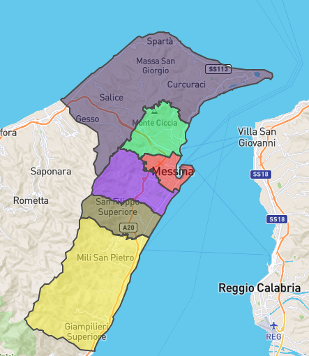
URBANITE use case scenario in Messina (Figure 1) aims to evaluate the effects of the extensions of the public transportation services in terms of frequency, itineraries and stops on traffic and multi-modal transportation.

Figure 1: Messina scenario - subdivision of neighbourhoods
In particular, a comparison of the impact on traffic between the different versions of the public transportation network was performed. Moreover, the scenario includes an analysis of the suburban roads around the city of Messina (that represent an important connection with the surrounding towns) in terms of traffic congestion and connection with the public transport network.
The described use cases are accessible thanks to the functionalities provided by the URBANITE UI, the integrated URBANITE’s framework at the User Interface level. The different analysis and visualizations opportunities offered aim to help the municipality’s technicians in the extension of the current public transportation network. The provided tools allow the users to interact with each visualization sheet by filtering and querying the underlying data.
Concerning the traffic congestion analysis in the city of Messina, Figure 2 shows some screenshots of the analysis of traffic changes during the time on selected roads entering or leaving the city.
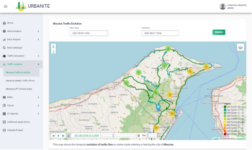
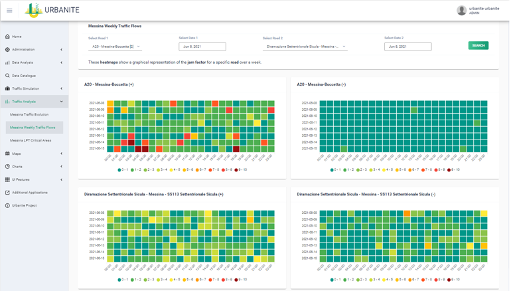
Figure 2: Traffic congestion analysis
The traffic jam factor of each road, in a specific time of the day, is represented by the colour of the road itself, following the provided legend. Data used to this purpose are also acquired and stored for real-time and historic analysis. Figure 2, on the right-hand side, illustrates the comparison analysis of the jam factors on two different roads of the city considering the time window of a week.
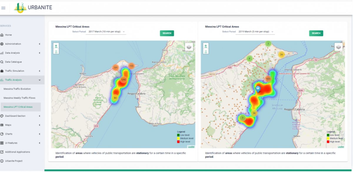
Figure 3: Messina LPT Critical Areas
To identify the areas of Messina where public transportation vehicles are stationary for a certain time in a specific observation period, the heat-map analysis (as the one in Figure 3) can be a useful tool.
The URBANITE dashboard allows to compare two different time slots to investigate if public transportation means are stationary in the same place in different time periods. In this case the data source is a historic database for the bus and tram position of the Local Transport Company.
URBANITE pilot case activities in Messina have given URBANITE partners the opportunity to set up and test tools which support decision-makers in obtaining information that is often difficult to understand and display methods which allow for immediate analysis. Thanks to these tools it is also possible to determine the effectiveness of mobility policies in use, compared to the past and, if it is the case, to improve them.
The next step is going to be to extend the functionalities described above to real time applications following the suggestions that we will collect during co-creation workshops with Municipality stakeholders.
For more information on Messina pilot case and the application of URBANITE tools in its smart mobility scenario you can read the full paper at the following link: https://urbanite-project.eu/sites/urbanite.drupal.pulsartecnalia.com/files/documents/2021Papers/03%20Martellaetal.pdf