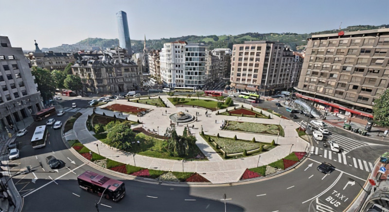

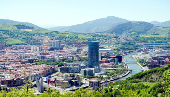
Bilbao is located right in the heart of a metropolitan area that extends along the estuary of the Nervión River and in the last 25 years has suffered an important urban transformation, from an industrial economy with heavy industry and harbour facilities to a service economy. Today, in the framework of the Intelligent Transport System Plans of the city, Bilbao’s investment has been oriented to promote public transport, user-centric information services (open data policy integrating static and dynamic standardized information), improve safety and reduce traffic congestion (new traffic management systems) and pollution .
 |  |
An eye on the future
In the framework of its Sustainable Urban Mobility Plan (SUMP), the city of Bilbao aims to better define and develop its mobility policies, prioritize measures for SUMP development, monitor SUMP development and evaluate the impact of mobility intervention on traffic, mobility patterns and SUMP indicators. By reaching these results the city of Bilbao would obtain a global vision of the city in terms of sustainable mobility, be able to take decisions based on updated data (being able to predict the impact resulting from applied measures), follow a more agile decisions-making process , translate measures impact into health and life quality indicators and access data coming from scattered sources that is automatically collected and integrated.
 |  |
What are the challenges?
To reach its aims the city of Bilbao has to face some issues, including not harmonised data , availability of mobility patterns based on not updated data, impossibility to forecast the impact of measures/policies on mobility, non dynamic communication among stakeholders involved in the definition and development of the SUMP.
 |  |
How can URBANITE help?
To help the city of Bilbao the URBANITE project is going to offer a unique point of access for mobility-related data allowing decision-makers to make decisions on the basis of the most updated information and through the setup and execution of simulations (e.g. to forecast the impact of decisions on traffic, to identify mobility patterns, etc.). In this perspective, the possibility to create charts and graphs to visualise mobility- related data or custom KPIs/indicators would allow the decision-makers to obtain at a glance the information they need to monitor mobility in the city. Since mobility-related data could come from different sources, each collected dataset could follow a different data format, so the technological solution offered by URBANITE will allow harmonisation of collected data according to common and well-defined data models. It is, also, relevant to ensure that collected data is the most updated and its analysis needs to be simplified, for instance, by pre-processing it. Furthermore, functionalities to search among collected data taking into account different criteria, would allow the decision-makers to reduce the time they spend in identifying the data they need. Finally, since different decision-makers could be involved in the decision-making process, the technological solution should facilitate the exchange of information among them.